Turkey’s parcel & land intelligence — in your pocket.
Instant parcel lookup, zoning info, AI-powered expert analysis, and earthquake/fault risk maps. A professional field tool.
- Up-to-date parcel data
- Zoning info
- Earthquake & fault maps
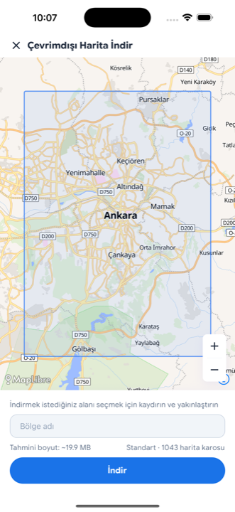
- Offline maps

All your land intelligence in one app
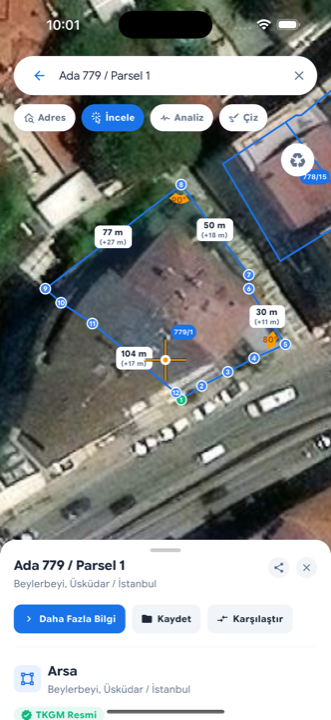
Parcel Lookup
Query parcels and see them on the map instantly.
Zoning Info
Inspect a parcel’s zoning status right on the map.
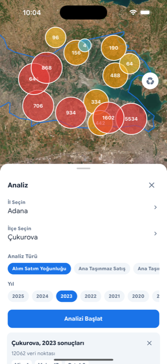
Instant Expert Analysis
AI-powered assessment for any parcel or region — in seconds.
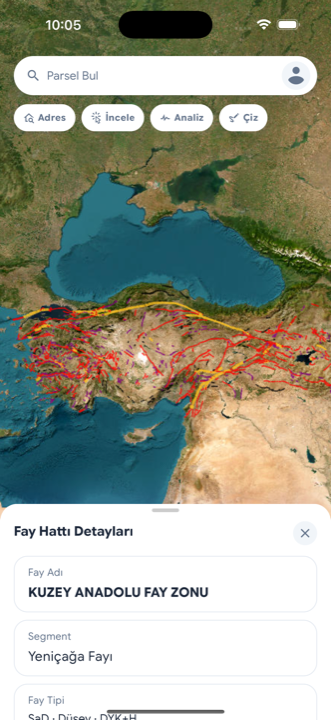
Risk Maps
Active fault lines, earthquake zones, landslide & geology layers.
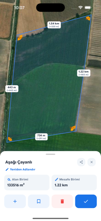
Draw & Measure
Draw on the map, measure area and distance, save your work.
Waypoints
Mark wells, poles, corner stones or damage spots with photos.
How it works
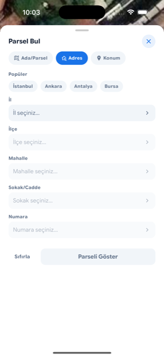
Find the parcel
Search by address, parcel number or coordinate; tap the map.
See zoning & risk
Zoning status, fault/earthquake and ground layers on one screen.
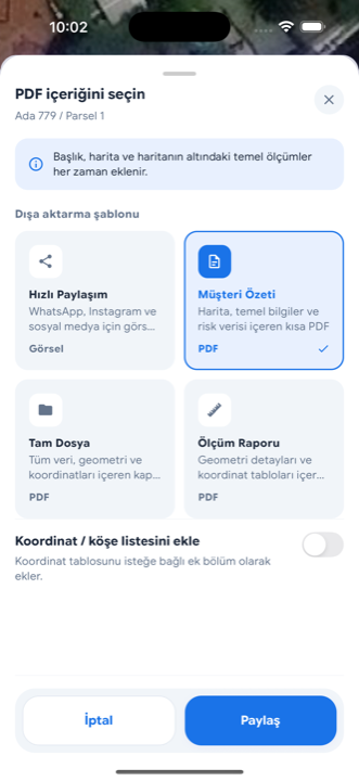
Analyze & share
Get an AI assessment, save it, share as PDF or a tappable location.
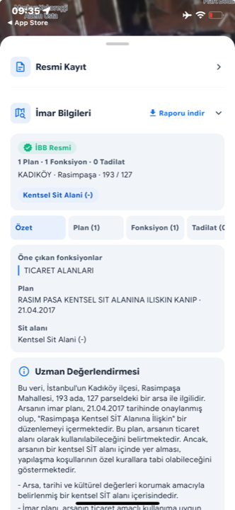
AI-powered expert analysis
Tap a parcel or a region; Topograf evaluates zoning, risk and environmental data in seconds and gives you a clear summary.
Who uses Topograf
Surveyors
Mark corner stones and control points in the field, measure, export.
Real estate & appraisal
Strengthen reports with zoning, risk and geotagged photos.
Farmers
Save wells, poles and field gates; find them again every season.
Get Topograf today
Start free on iOS and Android.